comparative Lake Calumet, 1889 vs. 1927 (vs. 1973)
Has Lake Calumet been changed over the last century? Topographic maps will not show how the lake has changed chemically or how similar the plant and animal life there is to that of a hundred years ago. But development of this area has been dramatic enough to clearly show up on the government's surveys. Lake Calumet has been shrunk.
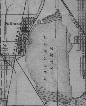
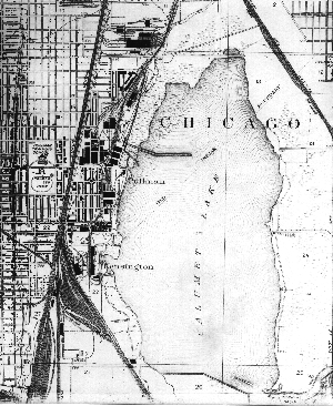
These depict Lake Calumet in 1889 and 1927. Unfortunately I was unable to make the 1973 image, which illustrates even more dramatic alteration, readable at this small scale. Therefore I have split up the area into four strips so that you can view pieces of 1889's and 1973's (or 1973's and 1927's) Lake Calumets side-by-side.
To look over these four sets of images, simply click on the maps and you will be transported from west to east -- from west of Lake Calumet, past western Lake Calumet, through central Lake Calumet, to eastern Lake Calumet.
Return to the Calumet maps page.
This page is at https://calpartner.tripod.com/maps/lakecal/index.html.
Updated 18th October, 1999.
Posted for the Calumet Heritage Partnership.